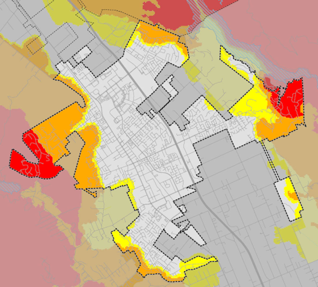
New state fire maps released for Morgan Hill show significant shifts in wildfire risk designations, with some areas seeing decreased hazard levels while others face stricter building and maintenance requirements.
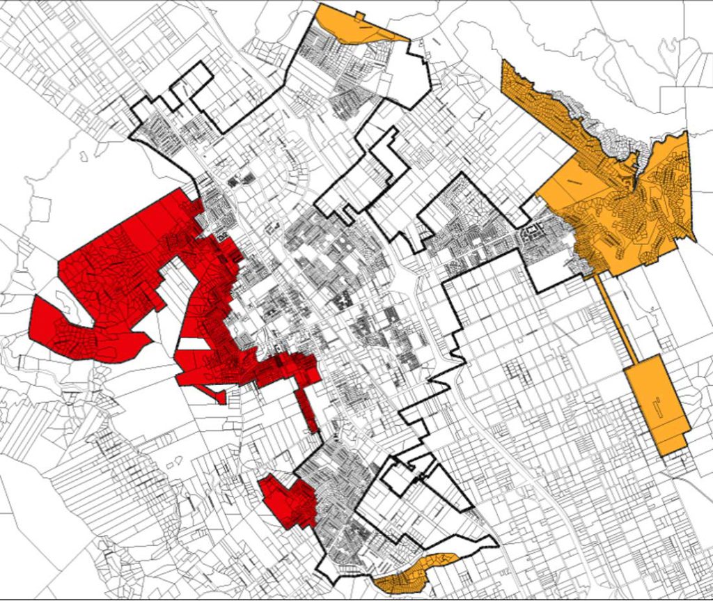
The California Department of Forestry and Fire Protection’s 2025 Fire Hazard Severity Zone maps, replacing versions from 2009, include reduced hazard severity in western Morgan Hill while eastern portions display varying degrees of increased risk.
“If you look at the new map, you can see there is some red, some orange, and a little yellow,” said Michelle Bigelow, Morgan Hill’s public information officer. “On the older maps, it was actually all red, so there are portions of western Morgan Hill city limits that have actually been reduced in hazard severity.”
The maps use color coding to indicate risk levels: red for very high, orange for high and yellow for moderate fire hazard severity zones.
Bigelow noted eastern Morgan Hill now shows predominantly orange (high risk) zones, with some yellow and red areas intermixed. These updated designations directly impact property owners through defensible space requirements, building codes and disclosure obligations during property sales.
“If you are now, say, in a High Hazard Severity Zone when you used to be in a Moderate one, you now are going to have some different defensible space requirements,” she said. “That has to do with how much space you have to clear around your home.”
Property owners in very high severity zones must maintain 100-foot defensible space clearance around structures as mandated by state law. Different building standards also apply depending on severity zone designation.
“Because this really is a land use and planning tool, construction that takes place in, say, a High or Very High Hazard Severity Zone will have different requirements,” Bigelow said. “It will affect new construction, and it could impact remodels depending on the extent of the remodel.”
The maps incorporate extensive scientific data including wind patterns, vegetation, ember production and movement, climate, topography and fire history.
“There is an incredible amount of information that goes into these maps,” Bigelow said.
State law requires periodic review of these designations to maintain accuracy as conditions change over time. City officials emphasize these maps primarily serve as planning tools rather than insurance determinants, addressing a major concern among residents.
“There is a lot of fear or confusion with homeowners’ insurance,” Bigelow said. “While some residents who live in areas that are prone to wildfires have seen their insurance go up, these maps don’t affect insurance rates or availability.”
California Insurance Commissioner Ricardo Lara recently reinforced this distinction in a public statement.
“Let me be clear: The CALFIRE hazard maps are not used for insurance rates or underwriting decisions,” Lara said in a publicly released fact sheet. “But they will empower communities with more accurate information about the very real hazards we face.”
Insurance companies develop their own wildfire risk models for determining coverage availability and premiums rather than relying on these state-mandated maps, which are primarily used in development planning.
“Insurance companies use wildfire risk models for determining where they write and renew policies, and what the premiums are, they do not use these fire hazard severity zone maps,” Bigelow said.
The state insurance commissioner’s office has implemented a “Safer from Wildfires” regulation program that clarifies actions homeowners can take to potentially receive insurance discounts based on wildfire mitigation efforts.
Residents concerned about their property’s new designation have limited options for appeal.
“Unfortunately, what Cal Fire tells us is that, at a state level, there is nothing in the government code that really allows for disputing or changing these maps,” Bigelow said. “The only leeway we have is to request that certain areas be more stringent, not less.”
The city is accepting feedback until May 23. Morgan Hill has emphasized these mapping changes will not affect emergency response services.
“These updates affect some properties in Morgan Hill, but they do NOT change how fire services are provided—our firefighters will continue to respond as always,” the city stated in a press release.
Residents can check their property’s current and proposed designation through an interactive map available on the city’s website, which can be found at morganhill.ca.gov/2617/Fire-Hazard-Severity-Zones-Maps.
Those with questions or feedback about the new designations can contact the city at fi*****@***********ca.gov before the May 23 deadline.