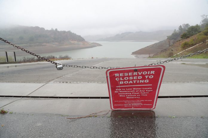
Wanting to avoid any chance of repeating last winter’s catastrophic flooding when Anderson Reservoir spilled over for the first time since 2006 due to heavy rains, water officials have kept the county’s largest water reserve at lower levels than what is mandated by the state.
In October 2017, the Santa Clara Valley Water District’s Board of Directors set a “40 percent exceedance rule curve to reduce the risk of flooding along Coyote Creek and provide adequate water supply while balancing other beneficial uses,” according to a district staff report. The restriction came on a recommendation from the Coyote Creek Flood Risk Reduction Ad Hoc Committee.
So, even after two days of consistent downpour Jan. 8-9, Anderson Reservoir—the largest reservoir in the county that provides about 25 percent of water that the entire county consumes each year—is only about 26 percent of its 90,373 acre feet capacity. An acre foot covers an acre of land 1 foot deep—enough water to supply two families of five for a year.
Due to the low water level, Anderson is also closed to all vessels.
The seismic restrictions imposed by state regulators allow Anderson to be filled up to about two-thirds of its maximum capacity.
“Releases from Anderson Reservoir have been minimal and haven’t changed in recent weeks,” according to SCVWD spokeswoman Gina Adriano. “By Dec. 1, we had already lowered the reservoir level to meet the board-approved flood risk reduction action…Since then, water has been released at a minimal level for groundwater recharge and to maintain fish habitat in creeks.”
In February 2017, Coyote Creek was unable to handle the substantial runoff from Anderson’s spillover, and widespread flooding overtook South San Jose neighborhoods, which were forced to be evacuated. The floods resulted in hundreds of thousands of dollars worth of damages.
Anderson Seismic Retrofit Project
The $400 million Anderson Seismic Retrofit Project, which is not expected to begin until 2020, is currently in the design phase and is “undergoing a series of independent reviews with industry experts to ensure best outcomes,” according to staff.
“We are working to complete a draft Environmental Impact Report for public review by summer 2018,” Adriano said. “We expect to complete the project design by 2019, after which we will need to apply for a series of permits. The district is aiming to break ground in 2020.”
The massive project, which will take between three to four years to complete with completion targeted for 2024, is being funded primarily through the district’s water rates, along with $60 million from the Measure B parcel tax.
Staff is expected to present a project update report Jan. 23 at the board of directors meeting.
Other reservoirs at low levels
Nearby Coyote, Calero and Chesbro Reservoirs—which also must operate under restrictions implemented by the state’s Division of Safety of Dams— are also currently at low levels as measured by SCVWD’s gages.
As of Jan. 10, Coyote is at 19.9 percent of its 23,244 acre feet capacity; Chesbro is at 31.1 percent of its 7,945 acre feet capacity and Calero is at 35.9 percent of its 9,934 acre feet capacity. Uvas Reservoir is at 34.3 percent of its 9,835 acre feet capacity.
“We’ve had to balance groundwater replenishment with releases for environmental benefits,” Adriano explained. “We also haven’t seen much rainfall thus far to fill the reservoirs. However, we receive most of our rainfall during the months of January through March, so we are keeping a close eye on the forecast.”
According to the National Weather Service, there was about 1.5 inches of rainfall between Jan. 8-9, but more wet weather is not expected again until Jan. 15. There has been 6.26 inches of rainfall this season, according to the SCVWD gage on Edmundson Ave.


