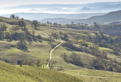
It is always a sweet surprise to drop into Halls Valley, the
setting for Joseph D. Grant County Park. Mount Hamilton Road twists
tightly as it contours across a densely forested ridge, when
suddenly the landscape relaxes and opens up into a broad bright
valley.
It is always a sweet surprise to drop into Halls Valley, the setting for Joseph D. Grant County Park. Mount Hamilton Road twists tightly as it contours across a densely forested ridge, when suddenly the landscape relaxes and opens up into a broad bright valley.
You may have driven past Joseph D. Grant County Park on your way to the top of Mount Hamilton. Since I first stopped at the park to explore, it has grown to be among my very favorite places. This time last year, I walked a lovely flat loop in Halls Valley below the main park grounds. Here, San Felipe Creek lazily twists its way through the wide open valley as it begins its long descent to Anderson Reservoir in Morgan Hill.
On that trip, I looked longingly up at the western slope of the ridge above Mount Hamilton Road. Fully half of the park’s terrain rests up there. So, this time, I drove another 10 minutes past the main entrance until I reached the Twin Gates parking area at the crest of the ridge.
Usually, the price for walking high on the crest of a ridge is the heart-pounding climb to get there. While the Cañada de Pala Trail has some uphill sections as it rolls along the ridge top, the real work has been done by Mount Hamilton Road. My only chore was to walk easily and gaze across sweeping, ever-changing views.
The route along the Cañada de Pala Trail is shaped like a balloon on a string; out the string (2.5 miles), around the balloon (4 miles), and back along the string again for a nine-mile round-trip if you walk it all.
Quickly, I was poised along the crest of the ridge, walking through open grasslands sparingly dotted with valley oaks leaving wide open views in every direction. On my right, the terrain dropped quickly down to Smith Creek. Just beyond, the entire reach of Mount Hamilton rose from the creek to the white observatory domes at its summit. On my left was Halls Valley below, Loma Prieta beyond, and occasional views of downtown San Jose. The spaciousness was immense. I am pretty sure that if I had spread my arms, I could have taken flight.
At the junction of the string and balloon, I went right staying high on the ridge. I stopped for lunch on a bench at Antler Point, a short side-spur near the top of the balloon and the high point on the trail. By this time, Smith Creek had merged with Isabel Creek and the new stream, Arroyo Hondo, cutting an impressive Yosemite-like chasm below me as it wound its way north. In the other direction, a clear view of downtown San Jose. This is fine dining.
Turning toward home, the trail drops briefly from the ridge crest down into Deer Valley, a cozy little dell cradled between mountain folds well above Halls Valley, before returning to the ridge and the return trip back down the balloon string.
For my money, this walk has everything: solitude, spectacular views, easy terrain. I seemed to scare a raptor from every oak I passed. I saw several golden eagles and a coyote even bounced unconcerned across my path. If the nine-mile round-trip distance exceeds your appetite, don’t be deterred. Even a short ramble here is worth the drive.
Another reminder: Please join me for a New Year’s morning hike at Rancho Cañada del Oro. We will meet at 9 a.m. rain or shine at the preserve parking lot (Where Uvas Road changes its name to McKean Road, south of Cinnabar Golf Course, take Casa Loma Road to the parking lot where the paved portion of the road ends). Bring your own food and water. No dogs are allowed. Email me with any questions at: ro********@*sn.com


