<
We are very fortunate that the hills west of Interstate 280 along the San Francisco Peninsula remain largely wild and undeveloped. Many acres of that land are open every day to the public at no charge or for a small day use fee, but not all.
<
San Francisco’s water supply comes from Hetch Hetchy Reservoir in Yosemite National Park as well as a complex of watersheds in Alameda County and the Peninsula. The Peninsula portion of the supply is stored in three reservoirs nestled in the San Andreas Fault west of Interstate 280. Upper and Lower Crystal Springs Reservoirs are visible out the driver’s side window on your Interstate 280 trips to San Francisco. A mile north, a third lake, San Andreas Reservoir, lies out of sight from the freeway.
<
The hills above these reservoirs are the Peninsula Watershed—23,000 acres of land owned by the San Francisco Public Utilities Commission that are largely closed to the public to protect the quality of San Francisco drinking water.
<
There is a bubbling controversy about opening access to the watershed. Several San Francisco supervisors are pressuring the commission to do so, but others worry about a number of harmful impacts public access would bring. While the policymakers sort that out, the public can still walk the 31 miles of trails on regularly scheduled docent-led hikes.
<
Through my affiliation with Committee for Green Foothills in Palo Alto, I was able to tag along on a hike into the Peninsula Watershed arranged by our executive director. On a recent weekday morning, a small group of us assembled near the entrance to Skylawn Cemetery at the crest of Highway 92 just before it drops down to Half Moon Bay. We shook hands with our docent, Jeff Crofton, who guided us through the cemetery to a locked gate. We parked on the other side, shouldered our day packs, and headed north on the Fifield-Cahill Ridge Trail.
<
The morning finger of fog that had poked over the Peninsula crest broke into drifting puffs as we set out down the trail. Though we were on the crest of the Peninsula hills, a dense Douglas fir forest hid the view along the first section of the trail. The dripping of condensed fog harvested by the tall conifers was the only sound that broke the muffled silence.
<
The peculiar branching pattern of many of the Douglas Firs along the trail surprised us. Rather than the normal single trunk Christmas tree architecture, many trees divided close to the ground in a peculiar candelabra-like shape.
<
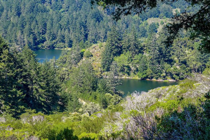
Soon the forest began to open and reveal the surrounding landscape. From many locations along Skyline Boulevard farther south, one can see the ocean, or the bay, or both, but we could see neither. A network of ridges with mini-watersheds blocked a wider view. Nestled below us in the crease between Montara Mountain and our location, we could see lonely Pilarcitos Reservoir holding water destined for Half Moon Bay.
<
Three miles out, thinning forest turned to chaparral, and we stopped for lunch. The Portola Gate at Sweeney Ridge was a few miles ahead, but refueled and refreshed, we turned toward home.
<
<
For information about the docent-led hikes on Fifield-Cahill ridge visit sfwater.org.


